2024 AGU Presentations Featuring ARM Data

The 2024 American Geophysical Union (AGU) Annual Meeting will be held from December 9 to 13 at the Walter E. Washington Convention Center in Washington, D.C., as well as online. With more than 25,000 attendees expected, the meeting might feel overwhelming. We make it easy for you to find ARM-relevant science, meet up with colleagues, and discover new connections during the event.

Below is a list of ARM-related AGU meeting highlights (all times Eastern). Session/presentation IDs are subject to change; please check the AGU Annual Meeting website  and download the meeting app for the most up-to-date information. Follow us on LinkedIn and Facebook for a real-time guide to relevant activities using the hashtags #ARMAGU and #AGU24.

Discover more ARM-related presentations and posters, as well as sessions, talks, and posters related to Atmospheric System Research (ASR).

Add your presentation to be featured on the ARM or ASR presentation web pages.

Attending AGU in person? Make sure to visit the ARM booth (#338) and ASR at the U.S. Department of Energy’s (DOE) Office of Science Biological and Environmental Research (BER) program booth (#139) in the AGU exhibition hall.  There you can view facility materials and meet with ARM and ASR representatives.

NEW for AGU 2024: Only plenary and keynote sessions will be live-streamed; named lectures, Union sessions, oral sessions, and town halls will be available for on-demand viewing only. Check the AGU schedule for more information.

CoURAGE Investigators’ Meeting

Lead scientist Ken Davis, Pennsylvania State University, will lead a Coast-Urban-Rural Atmospheric Gradient Experiment (CoURAGE) investigators’ meeting on Tuesday, December 10, from 4:30 to 6 p.m. in the Georgetown University room at the Marriott Marquis

Check Out ARM-Related Presentations:

Town Halls

DOE Town Halls

Related Interagency Town Halls

  • TH23A: A Discussion with Program Managers for Early-Career Scientists
    Tuesday, December 10, 12:30–1:30 p.m., Marquis 1–2 (Marriott Marquis)
    Primary Contact: Alyssa M. Stansfield, University of Utah
    Presenters: Alyssa M. Stansfield, University of Utah; Daniel Barrie, NOAA; Eric Thomas DeWeaver, National Science Foundation; Shaima Nasiri, DOE
  • TH23E: AmeriFlux Town Hall: What’s Next for AmeriFlux Science
    Tuesday, December 10, 12:30–1:30 p.m., Marquis 3–4 (Marriott Marquis)
    Primary Contact: Margaret S. Torn, Lawrence Berkeley National Laboratory
    Presenters: Daniel B. Stover, DOE; Sébastien Biraud, Trevor F. Keenan, You-Wei Cheah,  and Leila Constanza Hernandez Rodriguez, Lawrence Berkeley National Laboratory; Dario Papale, University of Tuscia

ARM-Related Presentations

Oral Presentations

Please note: On average, each oral presentation is scheduled to run no longer than fifteen minutes, so full session times are listed below for planning purposes. 

Posters

Invited Presentations

Oral Presentations

Please note: On average, each presentation is scheduled to run no longer than fifteen minutes, so the full session times are listed below for planning purposes. 

Posters

Eastern Pacific Cloud Aerosol Precipitation Experiment (EPCAPE)
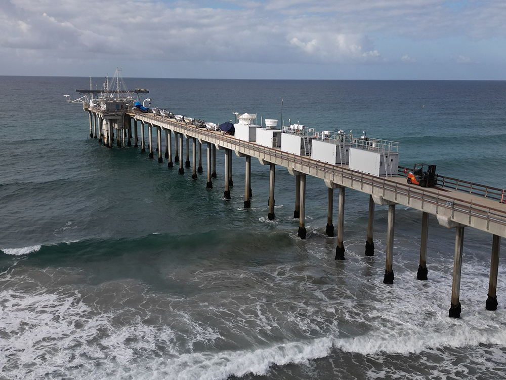
A view of the Pacific Ocean and ARM instruments on the Ellen Browning Scripps Memorial Pier in La Jolla, California
An ARM Mobile Facility operated on the Ellen Browning Scripps Memorial Pier in La Jolla, California, as part of the Eastern Pacific Cloud Aerosol Precipitation Experiment (EPCAPE). Photo is by Gregory Roberts, Scripps Institution of Oceanography.

The Eastern Pacific Cloud Aerosol Precipitation Experiment (EPCAPE), which kicked off in La Jolla, California, in February 2023 and ran through February 2024,  explored aerosol indirect effects on stratocumulus clouds to help improve their representation in earth system models. EPCAPE included the deployment of an ARM mobile observatory on the Ellen Browning Scripps Memorial Pier and a scanning cloud radar on Mount Soledad less than a mile inland.

Using data collected during EPCAPE, researchers will explore how pollution from the nearby Los Angeles metropolitan area affects marine aerosols and, by extension, the clouds near San Diego.

Surface Atmosphere Integrated Field Laboratory (SAIL)
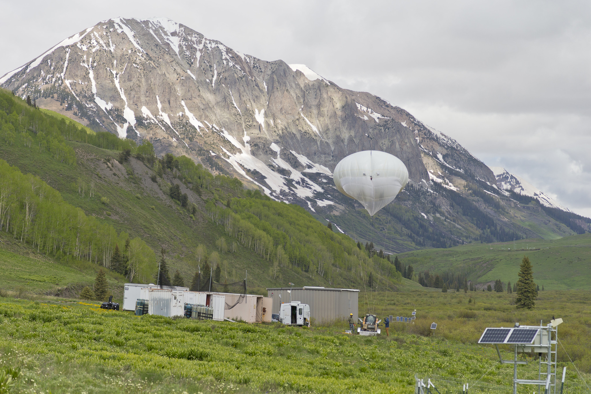
tethered balloon in green field
ARM’s tethered balloon system (TBS) and TBS instrument trailer are pictured during the Surface Atmosphere Integrated Field Laboratory (SAIL) field campaign near Crested Butte, Colorado. Photo is by Nathan Bilow.

The Surface Atmosphere Integrated Field Laboratory (SAIL) field campaign, which operated from September 2021 to June 2023, took place in the 300-square-kilometer (116-square-mile) East River Watershed near Crested Butte, Colorado. As part of SAIL, an ARM mobile observatory provided valuable atmospheric data that researchers can use to develop detailed measurements of mountainous water-cycle processes pertaining to the Colorado River, which supplies water for 40 million people in the Western United States.

Through SAIL, researchers from national laboratories, universities, research centers, and agencies will enable an atmosphere-through-bedrock understanding of mountainous water cycles.

TRacking Aerosol Convection interactions ExpeRiment (TRACER)
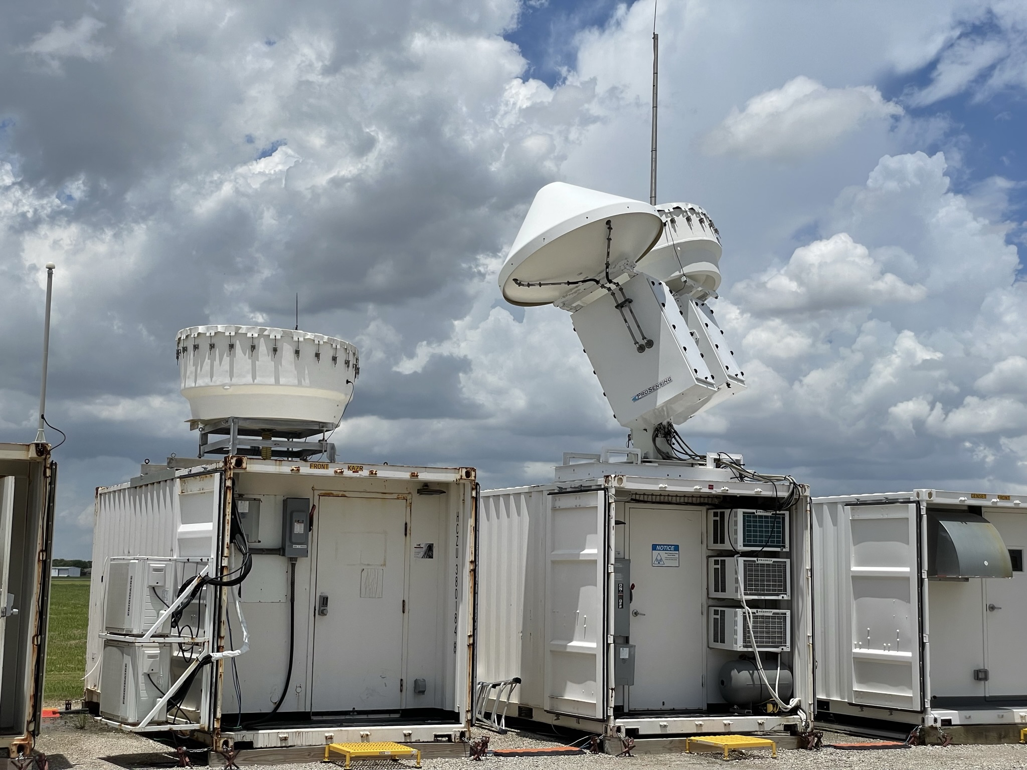
ARM radars capture cloud data in La Porte, Texas, during the TRacking Aerosol Convection interactions ExpeRiment (TRACER). ARM file photo.

The TRacking Aerosol Convection interactions ExpeRiment (TRACER), which ran from October 2021 through September 2022, provided convective cloud observations with high space and time resolution over a broad range of environmental and aerosol conditions around the Houston, Texas, region.

As part of TRACER, ARM deployed an ARM mobile observatory southeast of downtown Houston, a scanning precipitation radar south of downtown, and an ancillary site southwest of the city, where tethered balloon systems were launched. Together, these ARM measurements are helping researchers better understand the variability of aerosols and meteorology between the urban Houston area and surrounding rural environments.

TRACER’s lead scientist, Michael Jensen, will be the primary convener of the following TRACER-related AGU sessions:

Multidisciplinary Drifting Observatory for the Study of Arctic Climate (MOSAiC)
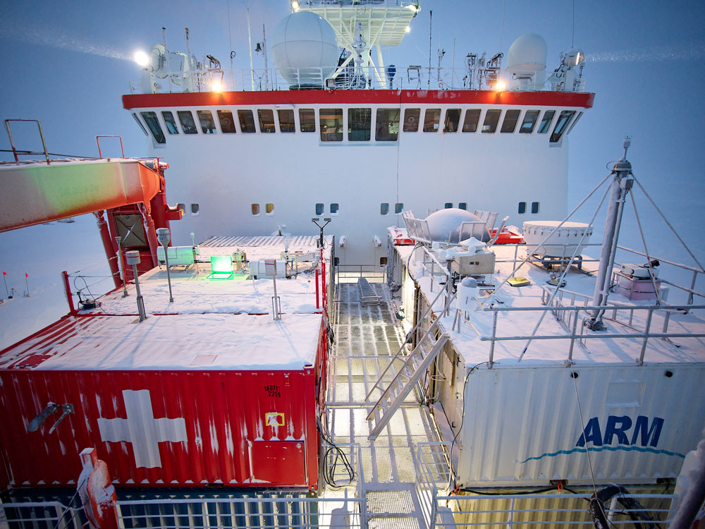
Research containers sit on the bow of the Polarstern.
For the Multidisciplinary Drifting Observatory for the Study of Arctic Climate (MOSAiC) expedition, ARM deployed more than 50 instruments, including these operating from the bow of the R/V Polarstern. Photo is by Michael Gutsche, Alfred Wegener Institute (CC BY 4.0).

The massive Multidisciplinary Drifting Observatory for the Study of Arctic Climate (MOSAiC) expedition set out to document the atmosphere, sea ice, ocean, biogeochemistry, and ecosystem in the central Arctic. More than 400 field participants and 60 institutions from 20 countries were active in the German-led expedition from September 2019 to October 2020. MOSAiC’s central observatory was the icebreaker R/V Polarstern, which froze into and then drifted with the arctic sea ice for most of the year. ARM provided the most atmospheric instruments—more than 50—to the expedition.

Matthew Shupe, a DOE-funded principal investigator and a co-coordinator of the MOSAiC expedition, will be the primary convener of the following Arctic-themed AGU session:

ARM 2025 Summer School: Open Science in the Forest

The Atmospheric Radiation Measurement (ARM) user facility will host an open science-focused summer school Monday, May 19, to Friday, May 23, 2025, at the University of Alabama in Huntsville.
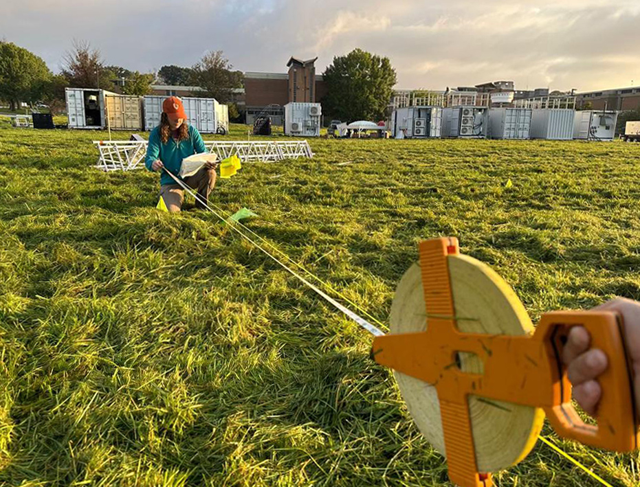
Apply for ARM’s Open Science Summer School. Applications are due Friday, February 14, 2025.

The “Open Science in the Forest Summer School: Connecting State-of-the-Art Models with Diverse Field Campaign Observations” is geared toward students from undergraduates to postdoctoral scholars. Planned activities include instructional talks, tutorials, and mentored hackathon sessions for attendees to work with ARM data and open-source software.

The overarching mission of the summer school is to enhance the scientific impact of ARM observations through the instruction of students in new techniques to gain insight into atmospheric processes using open science tools.

Objectives of the summer school are to:

  • increase knowledge about the range of ARM observations, demonstrate innovative and methodologically sound use of those observations, and connect students to a variety of knowledgeable resources (e.g., ARM instrument mentors)
  • introduce students to resources within ARM for high performance data-proximate computation
  • equip students with a variety of techniques for comparing high-resolution model output with ARM observations to study a range of atmospheric processes.

Brave New CoURAGE Campaign Set to Begin

Editor’s note (December 2, 2024): The story below originally published November 26, 2024. The Coast-Urban-Rural Atmospheric Gradient Experiment (CoURAGE) began official data collection December 1. See what data are now available in the ARM Data Center

In and around Baltimore, Maryland, scientists, technicians, and students are poised for a year of measuring an urban atmosphere

Kneeling on grass, Krista Matuska holds an end of a tape measure while another person, mostly out of the frame, holds the other side.
Krista Matuska, a postbaccalaureate researcher from Los Alamos National Laboratory from New Mexico, helps set up the main ARM instrument site in Baltimore, Maryland, for the Coast-Urban-Rural Atmospheric Gradient Experiment (CoURAGE). Photo is by Juarez Viegas, Los Alamos National Laboratory.

Do you want more CoURAGE?

Atmospheric scientists do, especially those that study climate and weather patterns affecting urban areas around the world.

What they have in mind is CoURAGE, the Coast-Urban-Rural Atmospheric Gradient Experiment. This yearlong field campaign in and around Baltimore, Maryland, will begin data collection December 1, 2024.

CoURAGE’s principal investigator is Pennsylvania State University professor Kenneth Davis, who oversees a team of 27 co-investigators.

The source of the campaign’s core instrumentation is the U.S. Department of Energy’s (DOE’s) Atmospheric Radiation Measurement (ARM) user facility. Instruments will measure properties of clouds, aerosols, precipitation, and solar and infrared energy at multiple sites.

Earth system models are not yet well adapted to predict climate and weather variability in cities. In part, that’s because robust, coordinated, and continuous field data in urban environments are hard to find.

CoURAGE was designed to help address this gap by taking detailed observations in and around Baltimore for a full year.

Continuous Atmospheric Data

A map indicates different sites around the Baltimore/Washington, D.C., region.
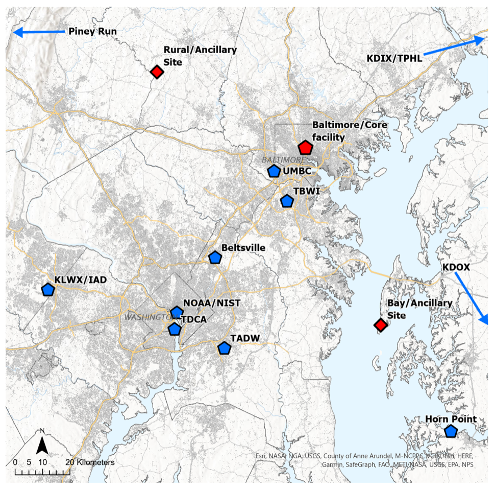
During CoURAGE, ARM’s deployed core and ancillary sites (red) will operate collaboratively with an existing regional network of atmospheric profiling and scanning radar stations (blue). Image is courtesy of Jason Horne, Pennsylvania State University.

CoURAGE and its city and regional partners will collect continuous atmospheric data from surface remote sensing instruments at four sites.

The main one, arrayed with instruments from an ARM Mobile Facility (AMF), is on the grounds of a former high school in Baltimore’s Clifton Park district. Three other sites will provide contextual city and upwind data: one urban, one rural, and one on Kent Island in Chesapeake Bay, an arm of the Atlantic Ocean.

All year, meanwhile, radiosondes launched at regular intervals will provide data on vertical dimensions of the urbanized atmosphere. ARM is also planning tethered balloon system flights during the campaign.

Research flights with non-ARM crewed aircraft will occur during CoURAGE’s two intensive operational periods, which are scheduled for winter and summer 2025.

NOAA will take part through a series of Baltimore and Washington, D.C., flights already planned for its Airborne and Remote sensing Methane and Air Pollutant Surveys (AiRMAPS).

CoURAGE-related collaborations by other research aircraft are pending, including possible contributions from NASA, the National Science Foundation, and the U.S. Naval Research Laboratory.

Scientific interest in the campaign is lively in other ways. On November 4, 2024, DOE announced a fiscal year 2025 funding opportunity through its Atmospheric System Research (ASR) program area. CoURAGE is one of the two research topics featured in the announcement. Pre-applications are due January 7, 2025.

Campaign Choreography

“When you are in theater and the show has to get out there, you have to drop stuff and make it happen. Field projects are the same way. You need to focus on the job and work together.”

Kenneth Davis, CoURAGE principal investigator

The CoURAGE team seeks to measure the interconnected atmospheric components at play in urban environments. They include the nature of surfaces, aerosols, atmospheric chemistry, clouds, and patterns of precipitation.

Davis is an expert on the boundary layer, the first mile or so of the atmosphere. That’s where humanity resides, weather happens, and critical exchanges of water, energy, and wind-borne momentum take place between the Earth and thin shell of clouds and gases above it.

The science and the complex array of instruments from multiple partners can be a lot to coordinate.

Davis, who studied physics and choreography as an undergraduate at Princeton University, says he is grateful for the dance experience while planning CoURAGE.

“When you are in theater and the show has to get out there, you have to drop stuff and make it happen,” he says. “Field projects are the same way. You need to focus on the job and work together.”

An Urban Proxy

A person leans over to look at the adjustment they are making to a set of radiometers.
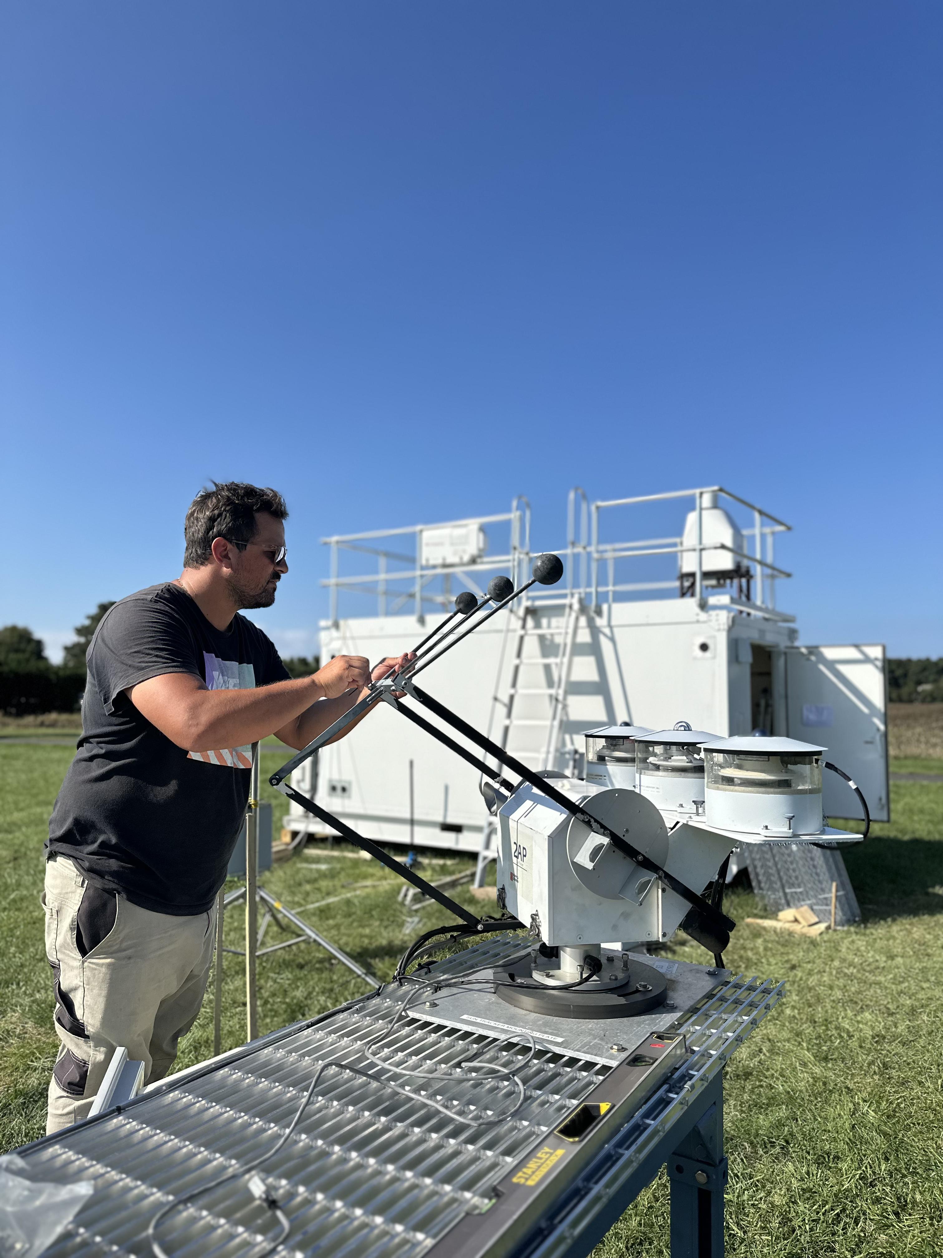
During the installation of ARM instruments on Kent Island, CoURAGE’s Chesapeake Bay site, Tercio Silva makes an adjustment to ARM radiometers. Silva is normally a site operator at ARM’s Eastern North Atlantic atmospheric observatory in the Azores. Photo is by Viegas.

CoURAGE is designed to improve model simulations of the urban atmospheric boundary layer, including its regional influences.

“This is supposed to serve all cities, not just Baltimore,” says Davis.

But why choose Baltimore for this campaign?

For one, the city, in combination with its neighboring rural and marine influences, represents atmospheric conditions that exist in many coastal urban centers in the Earth’s midlatitudes.

The open ASR funding call points to common topics of scientific interest in such areas. They include the need to better understand the impacts of city land use and sea and land breezes on regional temperatures, aerosols, clouds, precipitation, boundary-layer processes, and convective storm activity and intensity.

Cities and their surroundings influence regional climate and weather patterns in ways that models struggle to express. Satellite data suggest that urbanized areas of 50,000 people or more create downwind anomalies in precipitation that open land does not.

Cities also create their own weather, often at the scale of a square mile or less. Paved areas create heat islands that spike local temperatures. Canyon-like clusters of tall buildings alter wind patterns. Trees and other vegetation have cooling effects.

“It’s a complex environment,” says Davis. “That makes it challenging to get everything right. Interesting geographic locations like this also happen to be complex meteorologically.”

BSEC Beginnings

Davis was also attracted to Baltimore because of its human resources: a pre-existing consortium of community and university partners interested in the urban environment, from soils to atmosphere.

In 2022, DOE announced it would fund Urban Integrated Field Laboratories (UIFLs) in Baltimore and three other areas in the United States.

UIFLs reflect an increased interest among scientists in how a warming world will affect cities, as well as how future changes in weather and climate patterns will affect society.

One of the UIFLs is CoURAGE’s main partner: the Baltimore Social-Environmental Collaborative (BSEC), which Davis says made the ARM campaign possible by laying the groundwork for community engagement and relevant science questions.

BSEC’s proposal to become a UIFL was finished in June 2022 and awarded that fall.

Shortly after, in December 2022, DOE put out a call for proposals to deploy an AMF in an urban environment. It was intended to support the heightened interest of DOE’s Biological and Environmental Research program in the science of urban regions and their interactions with the climate system.

The CoURAGE proposal, motivated by the synergy of BSEC and the urban AMF call, says Davis, was finished in March 2023.

BSEC’s role is to generate “the climate science required for equitable climate action in Baltimore and beyond,” says its principal investigator, Ben Zaitchik, a Johns Hopkins University professor and CoURAGE co-investigator.

That means working with city officials and community to arrive at research questions and deploying the measurement systems needed to address those questions, he says. “CoURAGE is a powerful complement to those efforts.”

Community Weather Stations

A map is dotted to indicate different weather stations around the Baltimore region.
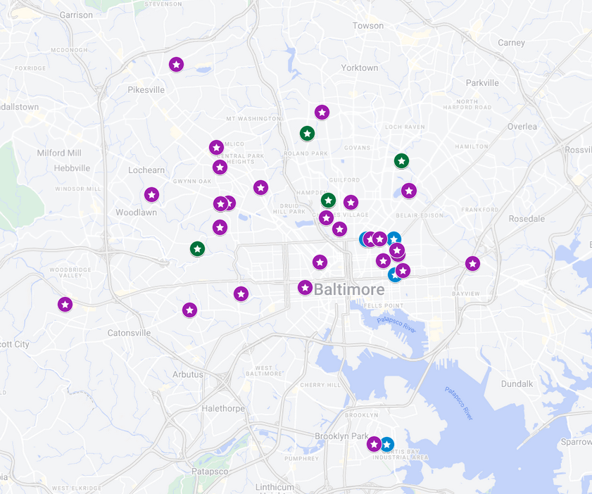
This map shows the locations of Baltimore Social-Environmental Collaborative (BSEC) weather stations, which measure temperature, humidity, rainfall, wind, and sunlight. Colors show the type of instrument: purple for ambient weather; blue for OttHydro (for measuring and analyzing precipitation, surface water, and groundwater); and green for where both systems are combined. Map is courtesy of BSEC.

CoURAGE co-investigator Darryn Waugh, also a professor at Johns Hopkins, set up a BSEC weather station network that began operating across Baltimore in 2023.

Some of the nearly 40 stations measure ambient weather conditions; some measure and analyze precipitation, surface water, and groundwater; and some stations measure both.

Most of the stations are at churches, schools, community gardens, and parks.

The data collected are comprehensive, says Waugh: neighborhood-scale measurements of “temperature and moisture of the air, rainfall, wind speed and direction, surface pressure, and the amount of sunlight—the kind of data needed to understand the causes and develop equitable solutions.”

Beyond the network of BSEC weather stations, only one National Weather Service station operates in Baltimore, in the Inner Harbor, he says. That is not enough to record how heat and other conditions vary across the city.

ARM’s CoURAGE measurements will provide additional detailed observations of aerosols, clouds, and atmospheric profiles to help understand the atmospheric processes driving the BSEC observations.

Baltimore experiences periodic “extreme heat, flooding, air pollution,” and more, says Zaitchik, who will serve as president-elect of the American Geophysical Union for the 2025–2026 term. “CoURAGE provides a unique suite of measurements that get at the atmospheric dynamics and chemistry behind these experiences.”

The campaign, he adds, will also “dramatically extend the kinds of science questions that BSEC is able to consider.”

Area Professionals

Instruments are on a container rooftop next to the ARM Aerosol Observing System and its stack.
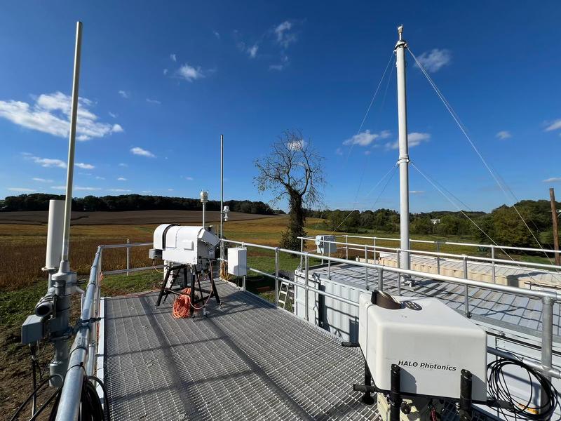
ARM instruments start to fill in CoURAGE’s rural site in Frederick County, Maryland, about 35 miles northwest of Baltimore. Photo is by Viegas.

Davis is grateful that CoURAGE is supported by BSEC’s commitment to community-engaged research.

“BSEC scientists regularly engage city stakeholders,” he says, including professionals from the Baltimore Office of Sustainability, the Baltimore City Department of Public Works, Old Goucher Community Association, and Maryland Department of the Environment (MDE).

An existing long-term observatory operated in Beltsville, Maryland, by MDE and Howard University will also supply CoURAGE data.

“CoURAGE will give MDE a better understanding of the three-dimensional feedback between the complex topography of the land-water-urban landscape and air quality,” said MDE air quality expert Joel Dreessen, “and how pollution and meteorology at the microscale result in intense gradients in air pollution, which can impact exposure and federal standard attainment in our region.”

Bringing in the Students

Most of all, CoURAGE is honey to busy-bee university students interested in science careers, including people from underrepresented groups.

Students from Morgan State and Howard—both historically Black universities—are involved in the campaign, as well as students from Johns Hopkins and Penn State.

A person holds up an instrument to help collect soil samples.
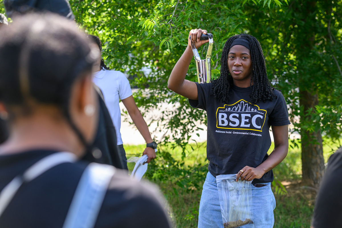
In July 2024, Johns Hopkins University undergraduate student Ariana Strasser-King, who is affiliated with BSEC, leads a soil sampling demonstration in Baltimore’s Howard Park neighborhood. Photo is by Travis Winstead III, Baltimore City College.

“CoURAGE is a great opportunity for Morgan State University students to participate, observe, and be inspired by a scientific operation with real-world impacts,” says Xiaowen Li, who leads the university’s climate studies program. She is also the lead scientist working to support ARM’s core site in Clifton Park, which is owned by Morgan State.

Li’s students will launch year-round weather balloons to contribute data to the campaign.

During CoURAGE, she says, “Campaign site visits will be part of our teaching in earth science-related courses”—so students can “develop exciting projects” that use live ARM data.

Morgan State students will also do outreach for CoURAGE. For example, two undergraduates will coordinate and conduct site visits for local communities and K-12 students.

“Finally,” says Li, “there are initiatives to involve students from (Morgan State’s) School of Global Journalism and Communication,” who will report on CoURAGE and climate.

‘An Exciting Time’

“As a young academic, being affiliated with a campaign of this magnitude is invaluable for research and networking.”

Jason Horne, Penn State PhD student

Imagine, too, the thrill of CoURAGE for Jason Horne, a PhD student working with Davis at Penn State.

“As a young academic, being affiliated with a campaign of this magnitude is invaluable for research and networking,” he says.

During CoURAGE, Horne will travel the few hours from school to Baltimore “as much as possible,” he says. “Being there in person is critical for understanding how operations look on the ground and engaging with community members.”

Horne also represents another important feature of CoURAGE: its monthly virtual science meetings, which bring together dozens of researchers across the country—many of them early in their careers—for updates and discussions.

Out of those meetings came an initiative that Horne helps guide: an urban modeling group “to advance the science of land-atmosphere interactions in the urban environment,” he says. “Conversations about modeling the urban environment are essential, and many people are working on the topic. Still, there are not many collaborations of this scale within the states. CoURAGE and (the UIFLs) mark a big first step.”

In the future, Horne wants to expand the conversation beyond the Baltimore campaign, domestically and internationally, and perhaps work toward a model intercomparison project and new proposals.

“Overall,” says Horne, “being a young academic in urban research is an exciting time.”

All it took was CoURAGE.

5 Years Later, Updates From 4 DOE Early Career Awardees

From the states of Washington, Texas, and Michigan, scientists tell tales of ARM data

Early Career Research Program awards from the U.S. Department of Energy (DOE), announced every summer, support outstanding national laboratory and university scientists beginning their careers. The money, time, and recognition they receive accelerates formative investigations that may guide the rest of their research lives.

Since starting in 2010, the program has granted 961 awards to fund projects up to five years in duration.

Let’s take a quick look at four early career projects that began in fiscal year 2019 and employed data from DOE’s Atmospheric Radiation Measurement (ARM) user facility.

All four awardees represent varieties of expertise in aerosols, the tiny particles suspended in the atmosphere that make clouds and precipitation possible.

And all four had to cope with the travel and time restrictions rising out of the COVID-19 pandemic, which was officially declared in March 2020.

While some of their projects are still in progress, all four are getting ready to present related research—or have their research presented—at the 2024 American Geophysical Union (AGU) Annual Meeting in Washington, D.C., and the 2025 American Meteorological Society (AMS) Annual Meeting in New Orleans, Louisiana.

Susannah Burrows, Earth Scientist, Pacific Northwest National Laboratory (PNNL)

Susannah Burrows is pictured in front of a white background.
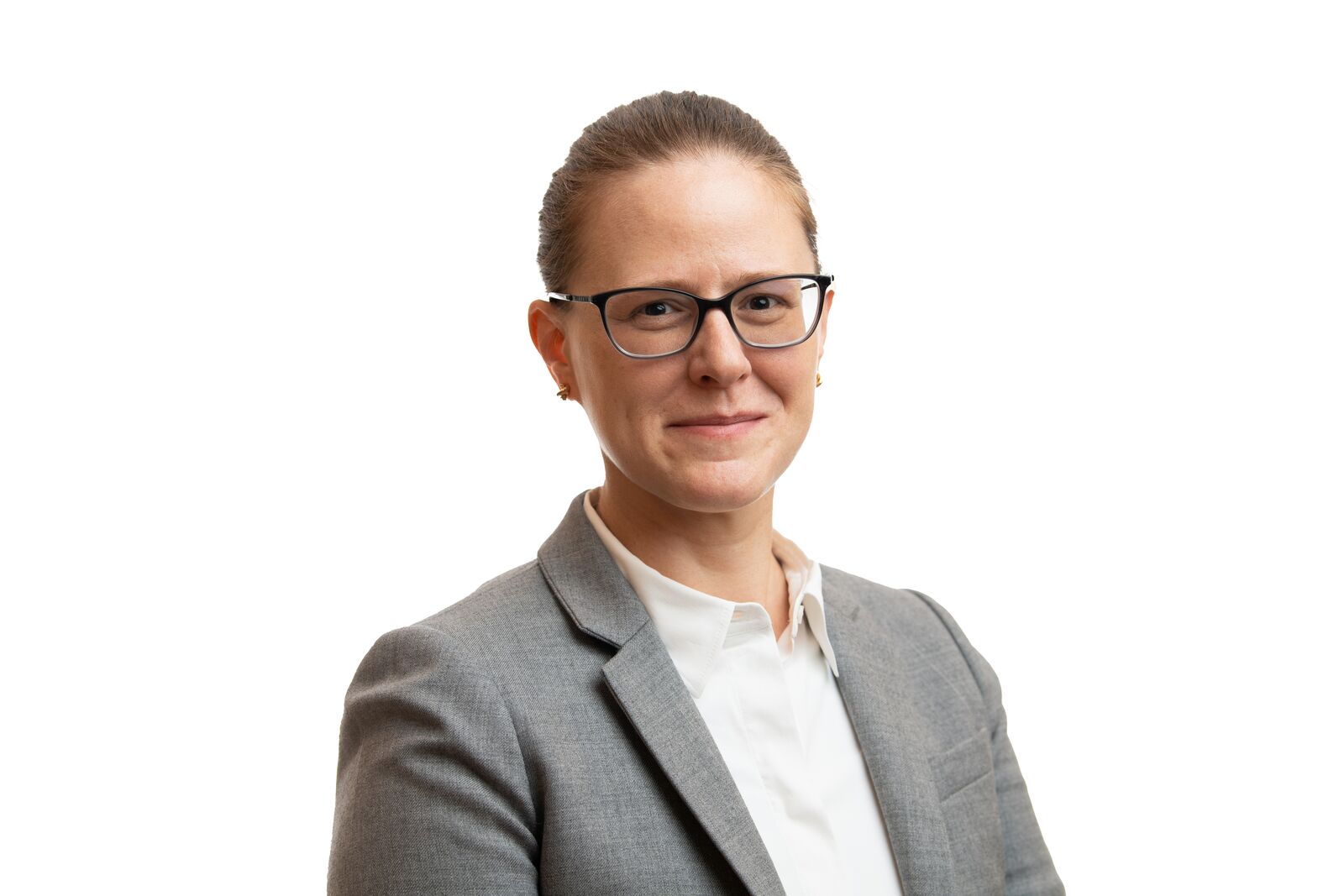
For her U.S. Department of Energy Early Career Research Program project, Susannah Burrows, an earth scientist at Pacific Northwest National Laboratory (PNNL) in Washington state, studied the sources, chemistry, and physical properties of ice-nucleating particles. Photo is by Andrea Starr, Pacific Northwest National Laboratory.

Burrows devoted her Early Career Award to investigating the sources, chemistry, and physical properties of ice-nucleating particles (INPs).

INPs contribute to the formation of ice in mixed-phase clouds (those containing both water and ice) by acting as a matrix for water droplets to freeze upon. They are 10,000 times rarer in the atmosphere than other particles and commonly originate from mineral dusts and sea spray aerosols.

Burrows’ work looked at INPs from both land and sea.

To examine INPs from land, in the fall of 2021, Burrows deployed a team for a month to ARM’s Southern Great Plains (SGP) atmospheric observatory in Oklahoma to collect data as part of her first ARM field campaign, Agricultural Ice Nuclei at SGP (AGINSGP).

Burrows also directed research on how sea spray aerosols contribute to INP formation. Her team looked at how much organic particulate matter at the ocean surface transfers to sea spray and, in turn, how many INPs are transferred from the ocean to the atmosphere.

On land or at sea, the focus is on “immersion mode” INPs, which when fully immersed in a cloud droplet activate ice formation at relatively warm temperatures, as low as minus 15 C (5 F). Without an INP, pure water droplets do not freeze until about minus 36 C (minus 32.8 F) or colder.

On April 11, 2022, AGINSGP’s most productive day, the Burrows team collected 150 INPs, “the largest number collected in a single day” during a field experiment, she says.

A summer storm begins to gather at the Southern Great Plains atmospheric observatory, with the edge of a radar in the foreground.
Burrows’ work used data from ARM’s Southern Great Plains (SGP) atmospheric observatory in Oklahoma. Dust-producing farmland and ranchland coexist there with ARM instrumentation. ARM file photo.

A June 2024 paper led by PNNL earth scientist Gavin Cornwell used AGINSGP data to report for the first time that particles were more likely to be active as INPs if they contain organic matter, particularly phosphates, as well as lead (previously reported) and mixed soil-organic particles.

Burrows speculates that, on land, mineral dusts with phosphate markers are associated with microbial biological activity in soils: for instance, fragments of bacterial cell walls, fungal spores, particles ejected into the atmosphere from soil or leaf surfaces by splashing raindrops, or from wind erosion of soils.

“We would like to trace such particles back to their sources,” says Burrows.

Those sources will be one focus of Cornwell’s 2024 DOE Early Career Award, she says, “which will allow him to take the next step on some of the (AGINSGP) research questions.”

For the ocean portion of her research, Burrows co-authored a January 2022 study led by former PNNL postdoctoral researcher Isabelle Steinke. It introduces a numerical framework for estimating concentrations of INPs linked to organic matter at the ocean surface. The paper identified steps in the sea spray-to-INP process that contribute uncertainty in models.

“We know there is a connection between ocean biology and particle emissions,” she says. “But we have not yet been able to get a really good process model.”

In the future, Burrows says she aims to explore “ice processes in clouds more broadly.”

In October 2023, she co-chaired a workshop with international researchers on processes of ice formation and the evolution of ice in clouds. It’s a challenging subject, says Burrows. “There are a lot of open questions.”

Burrows’ research at AGU 2024: “Characterization of springtime sources and variability of ice-nucleating particles in the agricultural region of the U.S. central Great Plains” (poster), Wednesday, December 11, 8:30 a.m. to 12:20 p.m. Eastern, Hall B-C (Poster Hall), Walter E. Washington Convention Center.

Naruki Hiranuma, Aerosol Scientist, West Texas A&M University

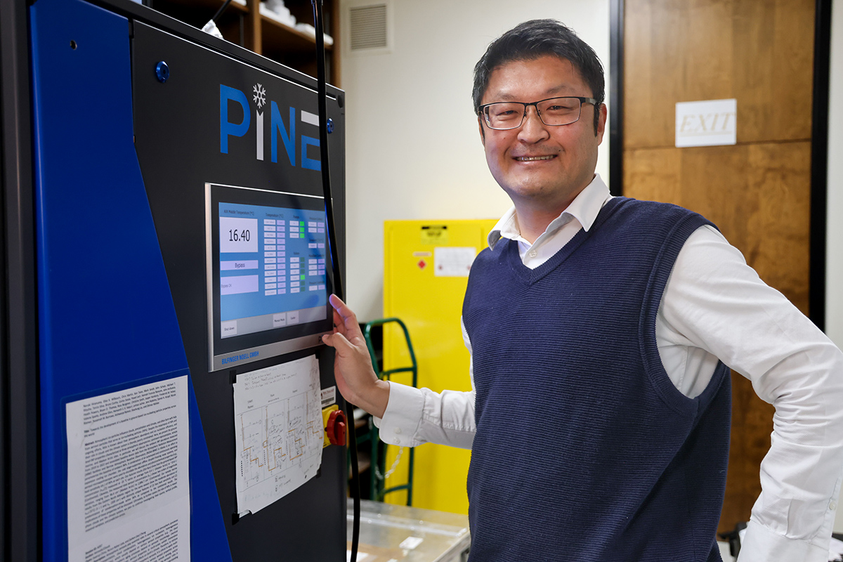
Naruki Hiranuma rests his hand next to the operating screen on the PINE chamber.
Naruki Hiranuma, an aerosol scientist at West Texas A&M University, stands next to the Portable Ice Nucleation Experiment (PINE) cloud chamber. Hiranuma deployed PINE to ARM’s fixed-location observatories in Oklahoma, the Azores, and Alaska as part of his Early Career Award work. Photo is by Darcy Lively, West Texas A&M.

Hiranuma, an expert in advanced aerosol measurement techniques, devoted the bulk of his Early Career Award work to field-testing a mobile and remotely operable device that counts the abundance of INPs in ambient air. About the size of a standard household refrigerator, the Portable Ice Nucleation Experiment (PINE) cloud chamber is a miniaturized version of a chamber operating at a laboratory in Germany.

INPs, which are hard to capture and measure, represent “one of the largest uncertainties in researching aerosol-cloud-climate interactions,” he says. They influence the life span and reflectivity of clouds containing ice.

Knowing more about regional variations of INPs around the world will help reduce predictive errors in present models of cloud-climate interactions. That is especially important because the “arctic amplification” of temperatures in a warming world is marked by an increase of INPs.

Hiranuma envisions a global network of robust, semi-autonomous PINE chambers for long-term INP measurements. PINE requires only a plug-in power source and an internet connection.

Because PINE is so easy to operate and monitor remotely, “it has opened new doors for new people to come into this research community,” says Hiranuma. He worked with two postdoctoral researchers and two master’s-level students. So far, three have published peer-reviewed papers. One published in May 2024 reported on a new Python toolkit for processing INP data.

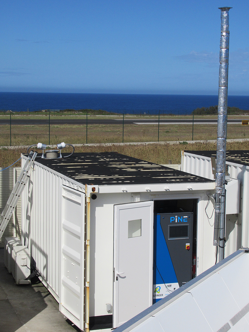
An aerosol stack rises above a container that holds the Portable Ice Nucleation Experiment (PINE) chamber. The Atlantic Ocean is seen beyond the PINE chamber.
In 2020, Hiranuma deployed PINE at ARM’s Eastern North Atlantic observatory in the Azores, west of mainland Portugal. He called the six-month deployment a demonstration of the device’s “extreme remote controllability.” Photo is courtesy of Larissa Lacher, Karlsruhe Institute of Technology.

There are only two PINE devices in the United States to date, with a third expected by late 2025. Hiranuma has an ongoing PINE data analysis collaboration with the pan-European Aerosol, Clouds and Trace Gases Research Infrastructure (ACTRIS), an ARM collaborator. It combines INP data around the world from ARM and ACTRIS sites.

During his Early Career Award work, Hiranuma executed the world’s first PINE field measurements, recorded its limitations (including measurable temperature ranges), and verified its readiness for the rigors of remote deployments in arctic, continental, and marine environments.

For 45 days in 2019, Hiranuma oversaw PINE field operations at the first of three ARM locations: the SGP. He says the deployment in Oklahoma was “the last sanity check before we went into really remote locations.”

In 2020, Hiranuma deployed PINE at ARM’s Eastern North Atlantic (ENA) observatory in the Azores, west of mainland Portugal. The six-month deployment during the pandemic, when travel restrictions were in place, demonstrated the device’s “extreme remote controllability,” he says.

Then, after a COVID-related delay, Hiranuma shipped PINE to Utqiaġvik (formerly Barrow), Alaska. It operated for two and a half years near ARM’s North Slope of Alaska (NSA) observatory, in what he calls his project’s “most challenging environment.”

The PINE chamber is back in Texas now, ready for U.S. field missions whose funding is pending. Hiranuma is focused on publishing the last few papers from his Early Career Award project.

Hiranuma is also thinking about next steps. Those include developing an airborne application for PINE as well as a PINE chamber capable of characterizing the physical and chemical properties of INPs.

The DOE project gave him valuable lessons in project and time management, he says, but also “so many new ideas.”

Hiranuma’s research at AMS 2025: “Multi-Seasonal Measurements of the Ground-Level Atmospheric Ice-Nucleating Particle Abundance in the North Slope of Alaska” (poster), Tuesday, January 14, 3 to 4:30 p.m. Central, Hall C, New Orleans Ernest N. Morial Convention Center.

Kerri Pratt, Atmospheric Chemist, University of Michigan

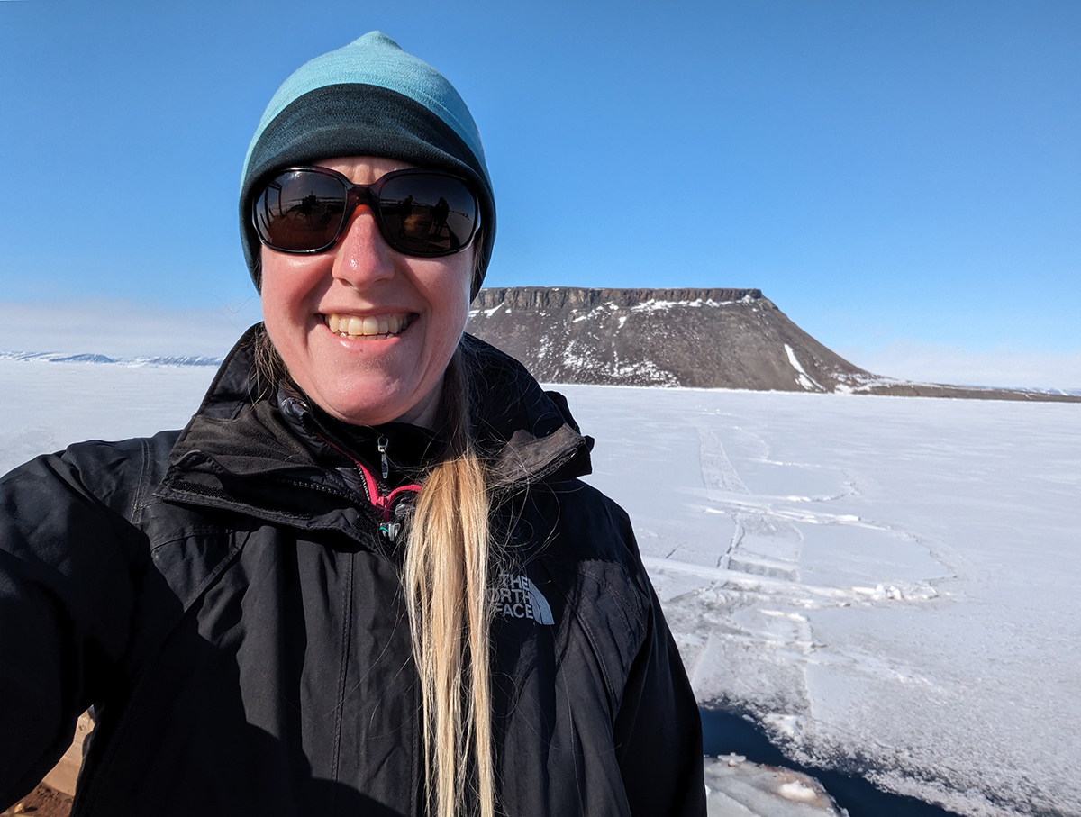
Kerri Pratt smiles in front of flat, snow-covered ground and, in the distance, a plateau sprinkled with snow.
Kerri Pratt, an atmospheric chemist from the University of Michigan, kept up her arctic research focus during her Early Career Award project. Photo is courtesy of Pratt.

In November and December 2018, just months after the Early Career Awards were announced, Pratt made a quick start on her research.

She and her team deployed instruments to the NSA to identify the sources and chemical composition of wintertime aerosols for her Arctic Aerosol Sources and Mixing States (ARCAEROMIX) campaign.

The signature piece of equipment deployed for the ARM campaign was a single-particle mass spectrometer used to measure the composition of individual aerosol particles in real time.

Pratt’s fast start on the Early Career Award also included Aerosols in the Polar Utqiaġvik Night (APUN), a 2018 investigation of aerosol measurements at the beginning of polar night, when such measurements are historically rare. Key to APUN was a delayed ice freeze-up in the Arctic Ocean near the NSA, where Pratt and her team observed breaking waves at the shore.

When open water exists at an unusual time, “you have a source of sea spray aerosol that is highly uncharacterized,” she says.

Pratt continued her focus on the understudied arctic winter during the 2019–2020 Multidisciplinary Drifting Observatory for the Study of Arctic Climate (MOSAiC) expedition in the central Arctic. She deployed a sampler to collect particles that are still being analyzed one by one at the Environmental Molecular Sciences Laboratory (EMSL), a DOE Office of Science user facility located on the PNNL campus.

In addition to studying sea spray aerosol, her group is investigating the speculation that sea salt aerosols are also produced by blowing snow or by snow sublimation—the process in which snow passes directly from a solid to a gas, bypassing the liquid state.

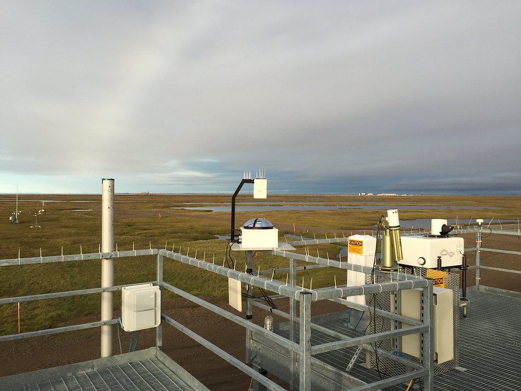
A total sky imager, Doppler lidar, and Cimel sunphotometer are on a rooftop overlooking snow-free Alaskan tundra.
During her 2015–2016 Summertime Aerosol across the North Slope of Alaska (SAANSA) campaign, Pratt collected data at what was then an ARM site at Oliktok Point, Alaska. SAANSA data later informed papers partly funded by her Early Career Award. Photo is courtesy of Pratt.

In the face of delays during this “highly COVID-impacted project,” says Pratt, “we went back to data collected during a prior ARM field campaign.”

The Summertime Aerosol across the North Slope of Alaska (SAANSA) campaign, led by Pratt, took place in 2015 and 2016 at the NSA and what was then an ARM site at Oliktok Point, Alaska, adjacent to the Prudhoe Bay oil fields. Pratt pointed to three related papers funded in part by her Early Career Award:

  • A June 2021 study found that droplets from frequent fog events reacted with oil-field emissions to form an SOA “that had never been documented in the Arctic,” says Pratt.
  • A March 2022 paper reported on what she called “the surprising observation” during arctic summer of solid-phase particles linked to new particle formation from open-water marine biogenic sources. This is more relevant than ever in a warming Arctic, where sea ice is declining and open water increasing.
  • A July 2024 paper reported “the first measurement-based quantification of aerosol mixing state in the Arctic,” says Pratt. (Mixing state is a measure of how chemical species are distributed across a population of aerosols.) The heterogeneous aerosol population in the oil-field atmosphere she studied counters the view that the Arctic has only homogeneous aerosol populations.

“There is growing attention to local arctic pollution sources,” says Pratt. “They are usually not studied. But with growing development in the Arctic, this is really important.”

Pratt’s research at AGU 2024: “Revealing the Chemical Composition of Sea Spray Aerosols over the Central Arctic Ocean during the Year-Long MOSAiC Expedition” (poster presented by Pratt’s PhD student Tiantian Zhu), Thursday, December 12, 1:40 p.m. to 5:30 p.m. Eastern, Hall B-C (Poster Hall), Walter E. Washington Convention Center.

Manish Shrivastava, Earth Scientist, PNNL

Manish Shrivastava is pictured in front of a white background.
PNNL earth scientist Manish Shrivastava has authored about 55 publications and given more than 20 invited talks since receiving his Early Career Award. Photo is by Starr.

Shrivastava set out to study secondary organic aerosols (SOAs).

SOAs are “secondary” because they are not directly emitted. Instead, they begin their life cycles in the gas phase; some go on to become particles in the “large chemical reactor” of the atmosphere, he says. From there, SOAs have far-reaching impacts on the climate.

For one, they account for most of the millions of particles in atmospheric haze, a common phenomenon that affects how much of the sun’s energy reaches the Earth’s surface. SOAs can also seed cloud formation.

Shrivastava focused on the interaction between SOAs and clouds. It’s a challenging task, complicated by the thousands of organic species involved in millions of dynamic atmospheric reactions, which occur both in the gas and aerosol phases.

Of special interest were SOA reactions with water in aerosols and cloud droplets, “the big missing pieces of the puzzle,” says Shrivastava. “We do not know what (these reactions) are doing to the climate and earth systems.”

He calls the SOA-cloud aqueous puzzle “too big to be solved in five years, but we have made a lot of progress.”

Since getting the Early Career Award, Shrivastava has stacked up around 55 publications and given more than 20 invited talks at universities and conferences.

One of his most recent papers, published in Cell in June 2024, used aircraft data over the Amazon to show new particle formation in biomass burning smoke that had previously been thought unlikely: ultrafine particles generated in the smoke from vegetation fires that modify both weather and climate by making shallow clouds deeper and precipitation heavier.

Ultrafine particles are less than 50 nanometers wide, or 2,000 times thinner than a sheet of paper.

In a February 2024 paper, Shrivastava and his team developed new measurement-based modeling approaches to simulate chemical processes that govern the reactions of biomass burning organic gases in clouds that form aqueous SOAs.

A portion of Shrivastava’s Early Career Award work relied on data from an ARM research aircraft deployed during the Green Ocean Amazon (GoAmazon2014/15) field campaign. Pictured is an aerial view of Manaus, Brazil, whose urban aerosols contrasted with those from the pristine Amazon rainforest nearby. Photo is by Jason Tomlinson, PNNL.

ARM data from the Amazon figured into a January 2022 paper reporting the importance of previously unrecognized soil and leaf chemistry pathways for production of SOAs and other atmospheric aerosols.

Shrivastava also made forays into machine learning. In an April 2022 paper, he and his team applied supervised machine learning techniques that facilitated and sped up an online analysis of aircraft aerosol mass spectrometer data to determine the sources of organic aerosols.

In addition, he co-wrote a March 2023 paper about embedding a physics-based deep learning neural network model within a detailed regional chemical transport model. This approach sped up calculations of SOA aqueous chemistry by the regional model.

Such machine learning applications, he says, can replace computationally expensive aerosol chemistry modules within current climate models, including those simulating chemical transport.

In a May 2024 study, Shrivastava and his team applied advanced mathematical causal analyses to identify key features affecting the formation of aqueous SOA from time-series data. They demonstrated that in certain applications, such mathematical approaches may surpass traditional machine learning techniques.

However, Shrivastava insists on the critical role of thoughtfully designed measurements in closing knowledge gaps in atmospheric processes. When integrated with models, he says, the right observational data provide the most valuable insights.

He tapped data from ARM field campaigns in the Amazon and at the SGP, as well as from laboratory experiments at EMSL.

In an October 2024 paper, Shrivastava and his team discovered the critical role of acid-base reactions in the formation of molecular clusters and their growth by extremely low volatility organic gases. Such atmospheric chemistry processes help explain measurements of newly formed particles at the SGP. The study also provides insights about the role of clouds in suppressing atmospheric chemistry that otherwise causes ultrafine particles to form.

In the same paper, Shrivastava conducted preliminary simulations of SOAs around ARM’s new Bankhead National Forest observatory in Alabama. The simulations showed that new particle formation in the forest might be limited by the availability of sulfuric acid gases.

“In all, it went really well,” he says of the Early Career Award work. “We achieved much more than we envisioned.”

Shrivastava’s research at AGU 2024: “Intense formation of ultrafine particles from Amazonian vegetation fires and their invigoration of deep clouds and precipitation” (poster), Wednesday, December 11, 8:30 a.m. to 12:20 p.m. Eastern, Hall B-C (Poster Hall), Walter E. Washington Convention Center.

Users Ask for New Arctic Aerosol Measurements, and ARM Listens

ARM installs set of aerosol instruments at neighboring NOAA facility in Utqiaġvik, Alaska

Instruments on a rack
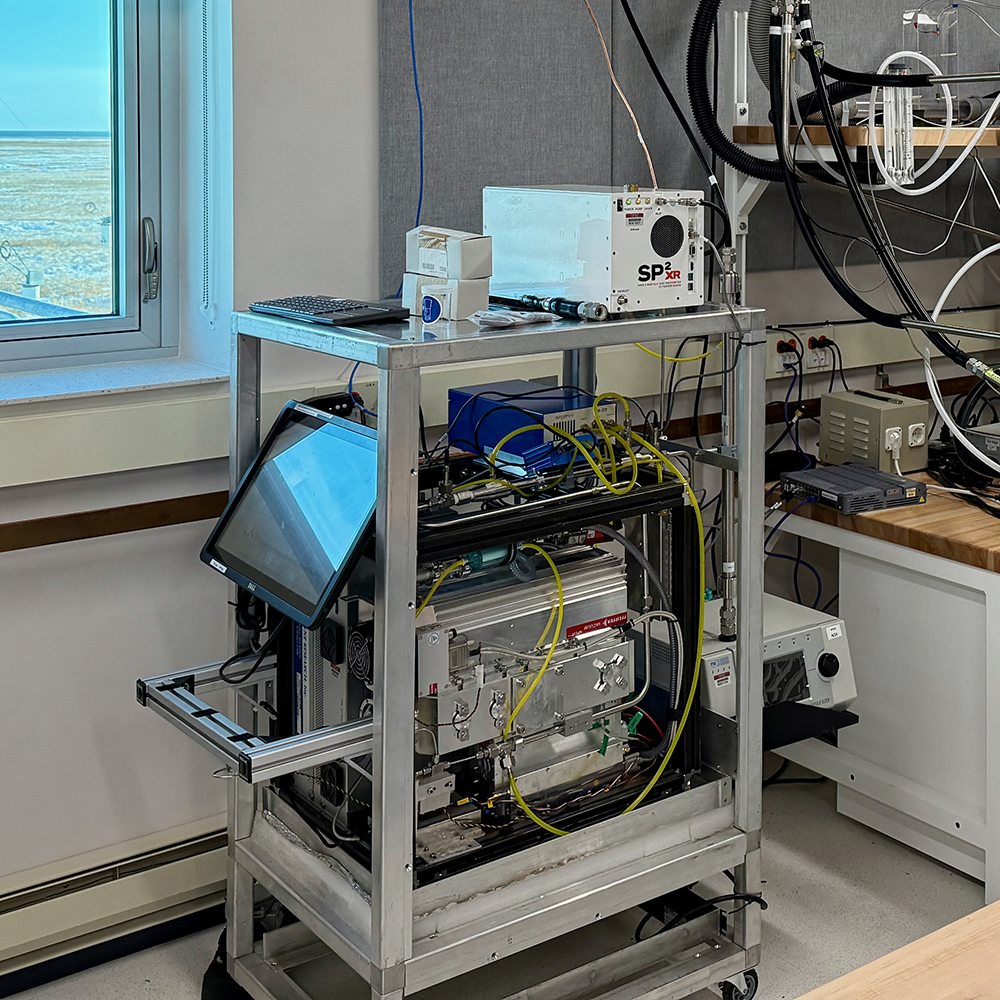
ARM aerosol instruments are now installed at a NOAA facility at Utqiaġvik, Alaska, near ARM’s North Slope of Alaska atmospheric observatory. The instruments are an aerosol chemical speciation monitor (taking up most of this rack), an aerodynamic particle sizer (on a shelf on the right side of the rack), and a single-particle soot photometer – extended range (on top of the rack). All photos are by Janek Uin, Brookhaven National Laboratory.

The Atmospheric Radiation Measurement (ARM) user facility, in collaboration with NOAA, is filling a need for additional aerosol measurements at the “top of the world” to help give scientists a richer picture of atmospheric particles in the Arctic.

For more than 50 years, NOAA’s Federated Aerosol Network has collected particle number concentration, scattering, and absorption data at Utqiaġvik (formerly Barrow), Alaska. The current NOAA site at Utqiaġvik is about 100 meters (0.06 miles) from the central facility of ARM’s North Slope of Alaska (NSA) atmospheric observatory.

ARM and NOAA have been partners in Alaska since ARM began operating the NSA in 1997. Given the existing NOAA aerosol measurements, ARM did not deploy its own Aerosol Observing System at the NSA. NOAA has historically provided aerosol measurements from its Utqiaġvik location to ARM, which has processed them to produce data products consistent with those at other ARM locations.

From October 1997 through August 2021, NOAA hosted aerosol instruments in its original Barrow Atmospheric Baseline Observatory building, which is classified as NSA external site X1 in the ARM Data Center. In 2020, NOAA finished constructing a new building next door—classified as NSA X3—to replace the X1 facility. Aerosol instrument operations in both buildings overlapped for almost a year before data collection ended at the X1 facility. X1 and X3 measurements are all available from the ARM Data Center.

Janek Uin and Maria Zawadowicz smile at the camera while standing outside a building with the NOAA logo on the front.
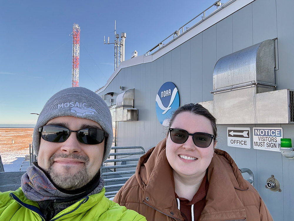
Uin (left) and Maria Zawadowicz, who are both ARM aerosol instrument mentors at Brookhaven, take a selfie outside the NOAA facility at Utqiaġvik, where they installed the new ARM aerosol instruments in early October 2024.

Other collaborators at Utqiaġvik have collected long-term data on black carbon mass concentrations, organic and inorganic components, and particle size distribution (fine fraction, 10 to 500 nanometers).

Even with all these measurements, observational gaps have remained. To help close these gaps, ARM has installed the following aerosol instruments at the NOAA site:

Together, these ARM instruments constitute a new NSA extended facility, E30.

ARM aerosol instrument mentors Janek Uin and Maria Zawadowicz, both from Brookhaven National Laboratory in New York, went to Alaska to install the instruments at the NOAA site in early October 2024. As part of the ARM-NOAA collaboration, NOAA technicians check on the ARM instruments as part of their daily rounds.

ARM’s lead aerosol mentor, Brookhaven atmospheric scientist Olga Mayol-Bracero, recalls several science meetings at which ARM users and scientists funded by the U.S. Department of Energy’s Atmospheric System Research (ASR) program area expressed the need for more aerosol measurements at Utqiaġvik.

The timing was right to move forward with these requests after the 2022 Joint ARM User Facility/ASR Principal Investigators Meeting in Rockville, Maryland. That was when Mayol-Bracero and others from ARM began talking with NOAA about how they could work together to add the new measurements that scientists wanted.

“ARM has been aiming to have aerosol measurements at NSA at least since 2017, so it is exciting to finally see this happening.”

Olga Mayol-Bracero, ARM’s lead aerosol mentor

“ARM has been aiming to have aerosol measurements at NSA at least since 2017, so it is exciting to finally see this happening,” says Mayol-Bracero.

Access the New Aerosol Data

APS and ACSM data from NSA E30 are now available in the ARM Data Center. The APS data can be cited as doi:10.5439/1407135 and the ACSM data as doi:10.5439/1865399. (For the ACSM, please note that these are baseline data, and mentor-processed data will be released at a later date.)

Work is underway to make the SP2-XR data available in the ARM Data Center. Once available, the SP2-XR data will also be accessible via the NSA E30 location page or through this ARM Data Discovery link to all NSA E30 data.

Get Additional Information

More details about the new NSA aerosol measurements can be found in the ARM Fiscal Year 2025 (FY2025) Aerosol Operations Plan.

If you have questions or comments about any of the instruments or their data, please reach out to the appropriate lead mentor—Zawadowicz (ACSM), Ashish Singh (APS), or Art Sedlacek (SP2-XR)—through ARM’s instrument mentor contact page.

For a comparison of the NSA X1 and X3 aerosol instruments, please read this 2021 ARM technical report.

Future NSA Aerosol Data

A Portable Ice Nucleation Experiment (PINE) chamber from West Texas A&M University operated at the NOAA site for nearly three years as part of an ARM field campaign to study ice-nucleating particles. The principal investigator, Naruki Hiranuma, says his team is aiming to release the PINE data to the ARM Data Center next spring.

Also, ARM plans to establish ice-nucleating particle measurements at the NSA in FY2025 as time and effort allow. Learn more in the ARM FY2025 Aerosol Operations Plan.

Updated: Virtual Registration Still Open for Bankhead Kickoff Meeting

Attendees will learn about opportunities associated with ARM’s newest observatory

Editor’s note (November 25, 2024): Registration remains open for people wanting to virtually attend the Bankhead National Forest site kickoff meeting. Registration for in-person attendees is closed. Below is the text of the meeting registration announcement as originally published in October 2024. 
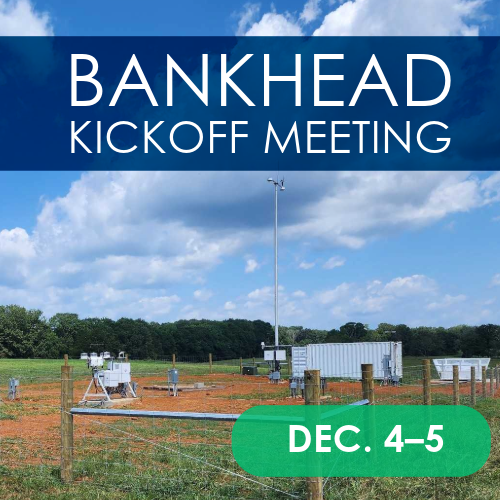
The Atmospheric Radiation Measurement (ARM) user facility will host a site kickoff meeting to introduce interested parties to its new Bankhead National Forest (BNF) atmospheric observatory, which began operations in early October 2024. During this event, attendees will learn more about the BNF and associated opportunities for science and collaboration.

The kickoff meeting is scheduled for Wednesday, December 4, and Thursday, December 5, 2024, at the University of Alabama in Huntsville. A virtual attendance option is also available.

In addition to presentations from ARM and U.S. Department of Energy representatives on what kinds of resources ARM and the new BNF observatory have to offer the scientific community, BNF hosts and local research partners will present their current work and future plans with the goal of bringing together potential collaborators within atmospheric, earth, and environmental science.

The first day is largely focused on getting to know who is doing and planning work in the area. The second day is broken into two parts: a morning session focused on helping scientists get started as ARM users and better understand ARM data and processes, followed by an afternoon site tour of the BNF.

Regarding the site tour, please note the following: Attendance on the tour is limited to 100 participants, and those who wish to visit the site must register for both the meeting and the tour. Foreign nationals must register for site access by Monday, November 4, and complete a follow-on approval process.

Registration is free for all meeting attendees. For those wanting to attend in person, registration is available on a per-day basis to give them scheduling flexibility.

The agenda, meeting and site tour registration forms, and additional event details are provided on the kickoff meeting website. Please register as early as possible; participation is limited to 100 in-person attendees per day and 300 virtual attendees overall.

On Tuesday, December 3, there will be an invitation-only tour of the BNF for media.

New Merged Product Integrates G-1 Flight Data

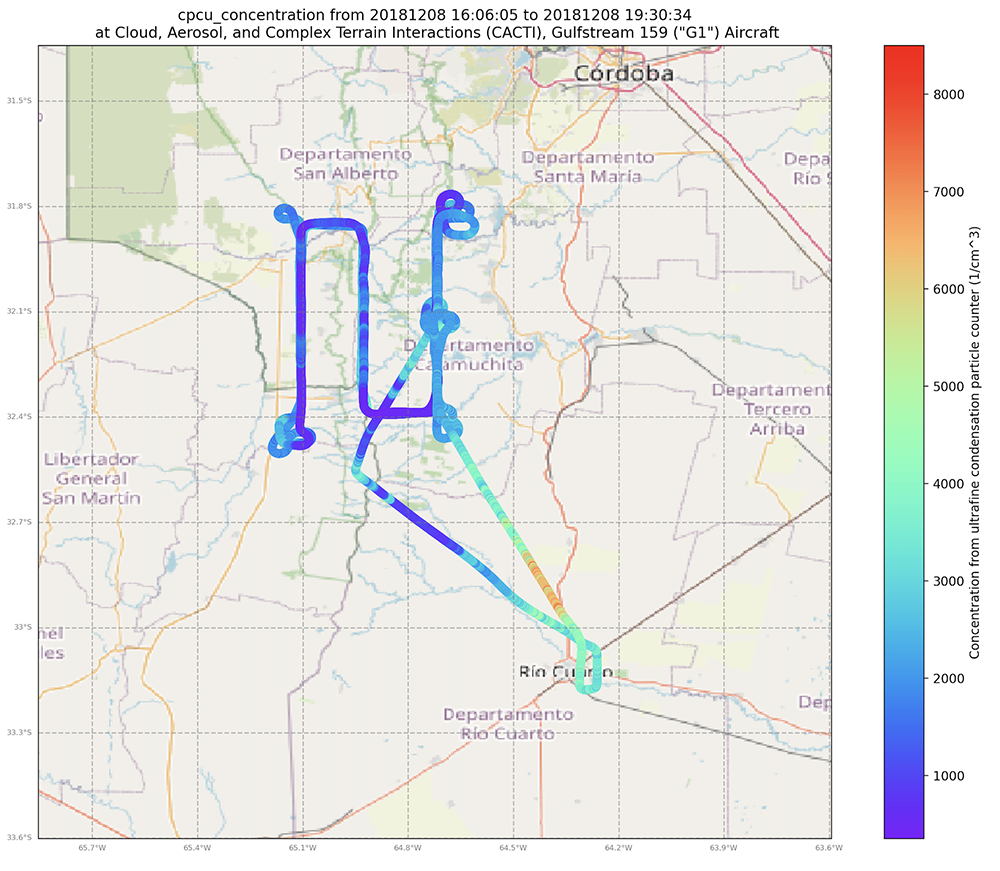
A map of a flight path near Córdoba, Argentina, shows variations in concentration from an ultrafine condensation particle counter (1/cm^3). The legend goes to above 8,000.
Aerosol concentration data from the G-1 ultrafine condensation particle counter are shown for an approximately three-hour flight on December 8, 2018, near Córdoba, Argentina, during the CACTI campaign. Image is from Krista Gaustad, Pacific Northwest National Laboratory.

From 2010 until its final science mission in 2018, the Gulfstream-159 (G-1) aircraft served as the Atmospheric Radiation Measurement (ARM) user facility’s main airborne research laboratory. The new ARM Aerial Facility (AAF) Merged value-added product (AAFMERGED VAP) for historical AAF G-1 campaigns has been developed to provide users with a set of frequently used G-1 measurements (e.g., atmospheric parameters, aerosol and trace gas concentrations) in a single netCDF file. This merged product allows users to quickly access the key measurements from nearly two dozen AAF products.

AAFMERGED evaluation data are now available for G-1 flights during the following ARM campaigns and date ranges:

More information about AAFMERGED is available on the VAP web page.

Scientists can use the new data now. Additional AAFMERGED data from the final six years of G-1 operations (2013 to 2018) will be released for the following campaigns:

Access the available AAFMERGED data in the ARM Data Center. (To download the data, first create an ARM account.)

To share your experience—such as how you use the data and how well they work for you—or to ask a question, contact AAF Science Lead Fan Mei.

To cite the AAFMERGED data, please use doi:10.5439/1999133.

ARM Seeks Lead Mentor for Trace Gas Measurements

The U.S. Department of Energy’s Atmospheric Radiation Measurement (ARM) user facility is seeking an instrument lead mentor (technical lead) for ground-based trace gas measurements deployed as part of ARM’s Aerosol Observing Systems (AOS).

ARM operates a suite of trace gas instruments across five observatories: Southern Great Plains (SGP), Eastern North Atlantic (ENA), and all three ARM Mobile Facilities (AMF1/AMF2/AMF3). As noted in the table below, these measurements include carbon monoxide (CO), ozone (O3), and sulfur dioxide (SO2).

ARM is also reviewing the addition of nitrogen oxide (NOx) measurements to the suite of trace gas instrumentation, and it is anticipated that management of these measurements will be included in this mentorship call.

(Note: The call does not include aerial-based measurements, which will be handled separately.)

A table shows carbon monoxide, ozone, and sulfur dioxide instrumentation that is available at the SGP, ENA, AMF1, AMF2, and AMF3. Carbon monoxide instrumentation is not available at the SGP, and sulfur dioxide instrumentation is not available at the ENA and AMF2. Those are the only exceptions.
This table of ARM trace gas instrumentation deployed with each observatory indicates vendor, model, and date procured. ARM’s North Slope of Alaska (NSA) observatory does not have any trace gas measurements and is excluded from the table.

Roles and Responsibilities

The successful candidate shall follow all lead mentor roles and responsibilities defined in ARM’s documents for mentors from universities or national laboratories. These include but are not limited to:

  1. reviewing all instrumentation and processes with the existing mentor team to ensure a smooth transition
  2. developing a plan for advancing ARM’s trace gas measurements based on feedback from ARM’s aerosol measurement science constituent group and the broader community
  3. developing technical specifications for the procurement of new instrumentation
  4. preparing and testing systems for deployment
  5. coordinating with the lead AOS mentor team on proposed changes/modifications to the hardware and software associated with trace gas measurements.
Aerosol Observing Systems at ARM's Southern Great Plains atmospheric observatory
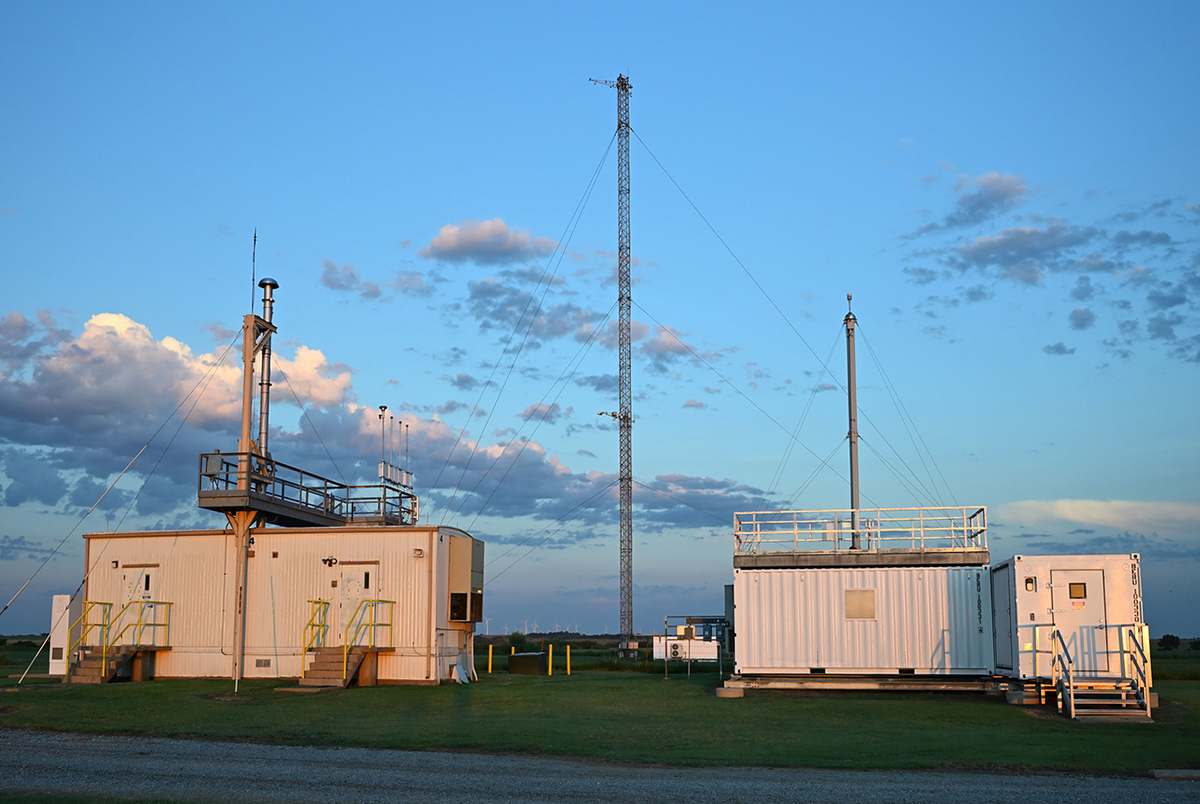
ARM seeks an instrument lead mentor (technical lead) for ground-based trace gas measurements deployed as part of its Aerosol Observing Systems (AOS). At the Southern Great Plains Central Facility near Lamont, Oklahoma, ARM instruments are located in the AOS to the right. The AOS to the left is used for guest instrumentation. Photo is by Nicki Hickmon, Argonne National Laboratory.

As noted in point 2 in the list above, the new mentor(s) will be expected to develop a plan for the future of ARM’s trace gas measurements. This plan is expected to include the continued operation of many current ARM trace gas instruments but may include updating processes and procuring new instruments. The plan can include the deployment of additional measurements such as CO at the SGP and NOx more broadly in ARM using commercially available, field-ready systems.

In addition, it is anticipated that the mentor(s) will review industry standards for these measurements, such as recent Environmental Protection Agency approvals for the implementation of nafion driers for O3 measurements, as well as develop calibration standards and processes traceable to industry standards.

Application Process and Deadline

To apply for this position, prospective candidates should provide a technical proposal for how they will carry out the functions described above and an accompanying cost proposal. Proposals should also include a description of appropriate experience with these instrumentation and/or measurements (CO, O3, SO2, NOx) and a CV for every member of the proposed team.

For this proposal, candidates should also describe their plan to implement NOx measurements in ARM, starting with the AMF3 deployment to Alabama’s Bankhead National Forest and expanding to other AMF deployments in the future as appropriate, in addition to any modifications they would propose making to existing measurements.

By the application deadline of Wednesday, January 15, 2025, all interested candidates should email ARM Instrument Operations Manager Adam Theisen with their proposal package and include the following:

  • technical proposal
  • cost proposal
  • plan to implement NOx measurements in ARM
  • proposed modifications to existing measurements
  • description of instrument and/or measurement experience
  • CVs of all team members.

New Plan Details ARM’s Aerosol Priorities for Fiscal Year 2025

In front of trees, the aerosol stack sticks up from the top of the Aerosol Observing System container at ARM's Bankhead National Forest atmospheric observatory.
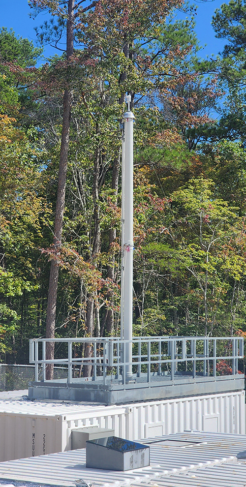
This ARM Aerosol Observing System (AOS) is now collecting data in Alabama. ARM’s aerosol operations plan for fiscal year 2025 includes information on AOS operations in Alabama and at other ARM sites. Photo is by Mark Spychala, Argonne National Laboratory.

The Atmospheric Radiation Measurement (ARM) user facility has released its aerosol operations plan for fiscal year 2025 (FY2025).

This is the second consecutive year in which ARM has published its aerosol operations plan, responding to recommendations from the Aerosol Measurement Science Group (AMSG). The AMSG is a constituent group that provides input to ARM Director Jim Mather to improve the operational performance, characterization, and science impact of ARM’s aerosol and trace gas measurements along with the development, processing, and delivery of aerosol data products.

Written by ARM lead aerosol mentor Olga Mayol-Bracero, additional aerosol instrument mentors, ARM aerosol science translator John Shilling, and others, the new document describes planned FY2025 activities related to operations of ARM’s ground-based Aerosol Observing Systems, calibration, engineering and development, and data products. It also provides outcomes from the ARM FY2024 Aerosol Operations Plan. ARM completed 16 tasks listed in the FY2024 plan, and five are in progress.

The FY2025 plan is now available for you to read on ARM.gov. If you have questions or feedback about the plan, please send them to Mayol-Bracero through the mentor contact page.

ARM Data Services Completes Successful Fiscal Year 2024

Editor’s note: This is an update from ARM Chief Data and Computing Officer Giri Prakash.

Giri Prakash in front of the Cumulus high performance computing cluster
Photo of Giri Prakash is from Oak Ridge National Laboratory.

I am pleased to share an overview of ARM Data Services’ significant accomplishments during fiscal year 2024 (FY2024). First and foremost, I extend my gratitude to the ARM staff and the broader scientific community for their invaluable support in advancing our development, engineering, and operational initiatives.

The ARM Data Center team demonstrated exceptional responsiveness by addressing over 1,100 tickets from external users and ARM staff, with most issues resolved within two to five days. This reflects our commitment to providing efficient and reliable support to scientists, principal investigators, and operational staff worldwide. The ARM data archive now hosts over 7 petabytes, offering a robust foundation of observational data to support cutting-edge atmospheric science.

The Data Discovery interface, a key tool for accessing ARM’s extensive data holdings, now includes improved search accuracy and integration with external repositories, making it easier for researchers to find and access the data sets they need. ARM also enhanced metadata management by incorporating automation and machine learning, improving the accuracy and scope of metadata recommendations. These developments significantly enhance the discoverability and usability of the more than 8,300 datastreams available to the community.

To further support researchers, ARM Data Services introduced a new calibration system for tracking instrument records and performance (we will share when this system is available to users) and a redesigned Data Quality Problem Report tool with enhanced search functionality and integration with other data systems. A modernized Field Campaign Dashboard now supports mobile and aerial campaigns with new features, including calendar views, mapping layers, and external data integration from NASA and NOAA. These improvements have been instrumental in streamlining field campaign data access and operational workflows for both science and operations teams.

A map of northern Alabama points out different ARM Bankhead National Forest sites and imagery being collected around the sites.
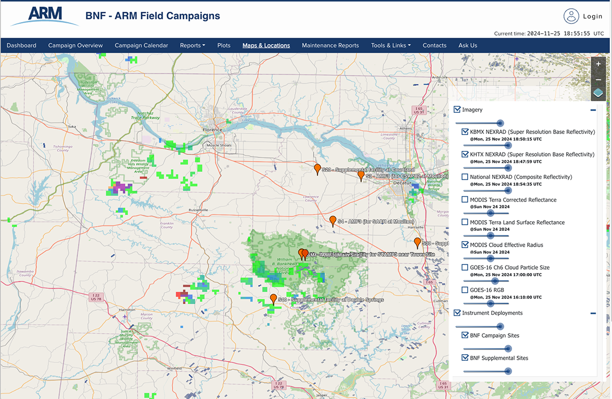
This screenshot from the ARM Field Campaign dashboard features a map of instrument deployments and imagery from around the Bankhead National Forest atmospheric observatory in northern Alabama.

ARM Data Services is advancing the ARM Data Workbench, an innovative platform designed to integrate 32 years of ARM data, robust computing resources, and an open-source software stack. This effort focuses on removing barriers to data access, enabling seamless interaction with ARM data and external sources. The workbench provides a collaborative, dynamic environment for data analysis and machine learning, using tools such as JupyterHub. By prioritizing FAIR (Findable, Accessible, Interoperable, and Reusable) principles, the Data Workbench ensures that researchers can easily explore and analyze data in a flexible and efficient manner.

The first phase of the Data Workbench, launched in 2022–2023, allows users to discover and stage data on ARM’s computing resources while leveraging Python-based tools such as Jupyter Notebooks. Building on this foundation, the next phase will introduce features such as automatic data staging; an intuitive user dashboard; and Data Studio, a comprehensive data analysis platform powered by ARM’s open-source libraries, including the Atmospheric data Community Toolkit (ACT), Python ARM Radar Toolkit (Py-ART), and ARM Data Integrator (ADI). Seamlessly integrated with tools such as the Data Discovery interface and ARM’s data submission systems, the Data Workbench will create a unified and user-friendly experience, positioning ARM as a leader in collaborative, data-driven atmospheric research.

Our community high performance computing (HPC) cluster, Cumulus, underwent significant upgrades during FY2024. With over 16,000 computing cores, Cumulus enables “data proximity computing” for fast, parallel processing of large-scale data analyses. Throughout the year, it supported more than 20 HPC projects, advancing computational research for the atmospheric science community. Researchers are encouraged to submit HPC proposals via the form available on the ARM website to leverage this powerful resource.

For support and feedback, users are encouraged to submit requests through the Ask Us option (also in the footer of each ARM.gov web page) or via the Feedback tab in Data Discovery.

ARM Data Services also made substantial progress in reprocessing historical data. The ARM Data Center reprocessing team managed new tasks while efficiently addressing a backlog of older jobs. The majority of FY2024 reprocessing tasks are now complete, with all reprocessed data available to users through Data Discovery.

ARM Data Services’ achievements in FY2024 reflect a steadfast commitment to supporting the research community with reliable data resources, advanced tools, and responsive user services. We will continue to collaborate with stakeholders and researchers worldwide to ensure ARM remains a vital resource for advancing atmospheric science.

For support and feedback, users are encouraged to submit requests through the Ask Us option (also in the footer of each ARM.gov web page) or via the Feedback tab in Data Discovery.

Thank you for your continued partnership, and we look forward to supporting your research in FY2025.